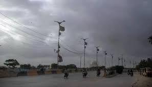
Islamabad, June 19, 2025: The Pakistan Meteorological Department (PMD) has forecast an intense spell of pre-monsoon activity starting from June 20, as moist currents from the Bay of Bengal and Arabian Sea begin entering the upper and central regions of the country. A westerly wave is also set to affect the upper areas by Thursday, further intensifying the weather pattern.
Under this system, duststorms, rain, strong winds, and thunderstorms—accompanied by isolated heavy falls and hailstorms—are likely in a wide range of areas from June 20 to June 23, with intervals of dry weather in between.
The regions expected to be impacted include:
Islamabad, Rawalpindi, Lahore, Faisalabad, Sialkot, Gujranwala, Gujrat, Murree, Galliyat, Kashmir, Gilgit-Baltistan, Abbottabad, Mardan, Peshawar, and parts of Khyber Pakhtunkhwa and Punjab. Interior Sindh districts like Sukkur, Larkana, Jacobabad, and Dadu will experience similar weather between June 22 to 24.
Southern and southwestern parts such as Zhob, Barkhan, Dera Ghazi Khan, Multan, Bahawalpur, and Sahiwal will also witness thunderstorms and windstorms from June 21 to 23.
Advisory & Expected Impacts
- High winds and lightning may cause damage to weak structures including trees, solar panels, electric poles, and vehicles, especially in central and northern regions including Islamabad.
- The ongoing intense heatwave will likely ease during this period.
- Farmers are urged to plan agricultural activities in line with the weather advisory.
- Travelers and tourists heading to hilly areas like Murree, Galliyat, and Swat should take precautionary measures.
- Urban flooding could affect low-lying areas in Lahore, Rawalpindi, Gujranwala, and Islamabad due to heavy downpours.
Stay tuned for updates and monitor local forecasts to ensure safety during this active weather phase.
Read More: NDMA Issues Severe Heatwave Alerts


